|
Videowalks |
| Downloadable walk guides for PC and mobile devices |

|
|
Videowalks |
| Downloadable walk guides for PC and mobile devices |
Video run time: 20 minutes 50 seconds

Save money! Buy all 3 parts of the Three Peaks Walk at the same time
Click here for details
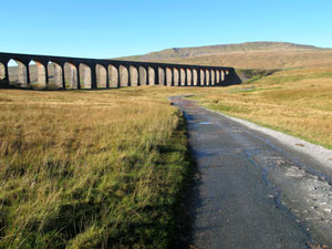
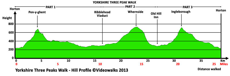
The Yorkshire Three Peaks Walk is a very demanding but rewarding walk, which takes in the summits of Pen-y-ghent (694 metres - 2,276 feet), Whernside (736 metres - 2,415 feet) and Ingleborough (723 metres 2,372 feet) all in one circular route. There is no set starting point, but the vast majority of walkers start at Horton in Ribblesdale, taking in the summits in the order shown above. The walk follows on from part 1 of the Three Peaks Walk (see separate text) which goes over Pen-y-ghent to arrive at the Ribblehead Viaduct. This second section as described here starts from the Ribblehead Viaduct and heads alongside the railway for just under two miles, before heading up Grain Ings and then across the stone flags to pull in alongside a wall that is then followed to Whernside's summit. The walk then continues by the wall, before dropping down to Bruntscar and along Philpin Lane to reach the B6255 about 50 yards from the Old Hill Inn. The Three Peaks Walk then follows part 3 (see separate text) over Ingleborough to arrive back at Horton in Ribblesdale. The route as described is the preferred route the Yorkshire Dales National Park Authority would prefer you to walk, so that the majority of the walk is on well maintained paths and helps prevent further erosion.
|
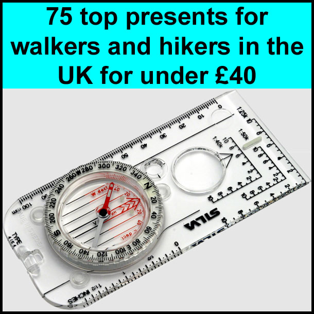
Best gifts for walkers - 49 top presents for hikers under £35 If you are wondering what to buy someone who likes walking, or searching for those inexpensive or personalised gifts for hikers, then look no further. We've put together a selection of practical presents under £35 that any walker or hiker in the UK would like to receive. Read our article: Best gifts for walkers - 49 top presents for hikers under £35 |
|
What to wear and take on your walk: If you are new to walking and want to know what to wear and take on your walk, or just want to know what to consider when buying your walking clothes and equipment then these articles are for you. We'll also take you through our favourite walking boots, walking jackets, walking trousers, rucksacks, backpacks, water bottles, mapping and safety equipment etc. of 2026. Read our articles: What to wear on a walk and What to take on a walk |
| Parking: | The second part of the Three Peaks Walk starts from the T-junction close to the Ribblehead viaduct. There is parking nearby for support vehicles (grid reference SD 765 793). |
| Directions: | Google Maps: get directions here / What3words: response.trickling.sweeping |
| Walk distance: | 6.9 miles (11.1 Km) |
| Estimated walk time: | 3 hours 10 mins |
| Height climbed: | 470 metres |
| Grade: | 2-C: A medium length walk that has rugged terrain and some steep climbs |
| Peaks / summits: | Whernside |
| Map: | Ordnance Survey - Explorer OL2 (Yorkshire Dales - Southern & Western Area) Buy this map from Ordnance Survey |
| Walk features: | Birds, Cafes, Flowers, Hills or Fells, Stream or River, Views, Waterfalls, Wildlife |
| Facilities / refreshments: | 2 pubs and cafe in Horton in Ribblesdale. More pubs, cafes and tea-rooms in nearby Ingleton and Settle |
| Nearest town: | Ingleton and Settle |
| Local self-catering accommodation: | View self-catering accommodation close to the start of this walk |
| Walk Tags: | Three Peaks Walk, 3 Peaks walk, Whernside, Whernside walk, Pen-y-ghent, Pen-y-ghent, Video walk, 3 peaks video walk, Ingleborough, Yorkshire Dales, Yorkshire, Video walk, Ribblehead Viaduct, Station Inn, Bleamoor, Bleamoor sidings, Force Gill, Force Gill Waterfall, Grain Ings, Greensett Moss, Greensett Tarn, Bruntscar, Philpin, Old Hill Inn, Chapel-le-dale |
| Video run time: | 20 minutes 50 seconds |
Hill profile:
Video preview:
The Three Peaks Project
In 1987 the path network in the Three Peaks area was one of the most severely eroded in the UK, with some paths across the more fragile parts of the route having grown to 50m wide in places.
Since then, a great deal of effort and money has gone into improving of the network and helping the surrounding vegetation to recover. So far, about 27kms of public footpath and bridleway have been transformed, but the number of staff managing the rights of way in the Three Peaks has dwindled from 13 at the start of the original Manpower Services-supported project in 1987 to two.
This means that, despite the support of a team of Dales Volunteers, the National Park Authority is slowly but surely falling behind with maintenance. The knock-on effect is that some sections of path need major work doing to them far more frequently - perhaps as often as every five years - when a 10-year lifespan should have been expected. As well as the extra work, every additional project adds to the maintenance burden. Read more here on The Three Peaks Project.
So if you are walking the Three Peaks, or just generally walking in the Three Peaks area, please consider giving to The Three Peaks Project:
If you are doing the walk for charity, please consider giving some of your donations to The Three Peaks Project - every £1, £5, £10 etc. that you can give greatly helps with the upkeep of the paths.
Other download options available
The Full Walk - Pen-y-ghent -> Whernside -> Ingleborough |
Downloads are available in different resolutions for your PC, SmartPhone and other mobile devices and are provided in mp4 format for maximum compapability with a wmv version also available. You also receive a PDF document with the walk details and an Ordnance Survey map extract that you can print out or view on your mobile device. Watch the video on your PC or burn to a CD or DVD to watch on your TV to see in detail the walk before you set off.
All downloads are available instantly.
Once saved to you device, you can then play them an unlimited number of times whenever you want!