|
Videowalks |
| Downloadable walk guides for PC and mobile devices |

|
|
Videowalks |
| Downloadable walk guides for PC and mobile devices |
Video run time: 32 minutes 46 seconds

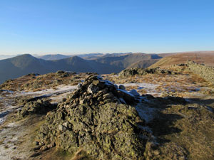
A glorious horseshoe round starting and ending in Kentmere, taking in the skyline of the Kentmere valley. The walk heads out along the Garburn Pass before turning North to reach Yoke, the first summit of the day. From here a succession of fells are passed (Ill Bell, Frostwick and Thornthwaite Crag), before turning East to reach Mardale Ill Bell and then dropping down in to the Nan Bield Pass, which affords views of Haweswater over Small water. Harter Fell is the next peak before turning southwards to complete the Eastern skyline via Kentmere Pike and Shipman Knotts. The length of the walk is rewarded with excellent panoramas from each of the summits. Wainwrights notes that "Many motorists approaching from the south regard their sighting of Windermere as the beginning of the Lake District and head eagerly along the A591 until it comes in to view, unheeding or unaware of a side road signposted 'Kentmere' as they pass through the village of Staveley en route. By doing so, they miss the loveliest of the lesser known Lakeland valleys - Kentmere is delightful in all seasons." The A591 may well now bypass Staveley, but this still holds true.
|
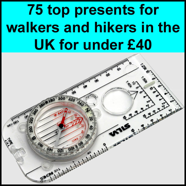
Best gifts for walkers - 49 top presents for hikers under £35 If you are wondering what to buy someone who likes walking, or searching for those inexpensive or personalised gifts for hikers, then look no further. We've put together a selection of practical presents under £35 that any walker or hiker in the UK would like to receive. Read our article: Best gifts for walkers - 49 top presents for hikers under £35 |
|
What to wear and take on your walk: If you are new to walking and want to know what to wear and take on your walk, or just want to know what to consider when buying your walking clothes and equipment then these articles are for you. We'll also take you through our favourite walking boots, walking jackets, walking trousers, rucksacks, backpacks, water bottles, mapping and safety equipment etc. of 2026. Read our articles: What to wear on a walk and What to take on a walk |
| Parking: | There is only a small amount of parking in Kentmere near to the village hall, so this walk is best for an early start or midweek. There is really no other roadside parking. In summer, a field near to the bridge below the church is generally opened and can be used for a small fee, but this is limited to 28 days per annum. There is also an infrequequent bus service from Staveley. (grid reference NY 455 041) |
| Directions: | Google Maps: get directions here / What3words: encoding.grumble.songbird |
| Walk distance: | 12.6 miles (20.2 Km) |
| Estimated walk time: | 6 hours 40 minutes |
| Height climbed: | 1 metres |
| Grade: | 3-C: A long walk that has rugged terrain and some steep climbs |
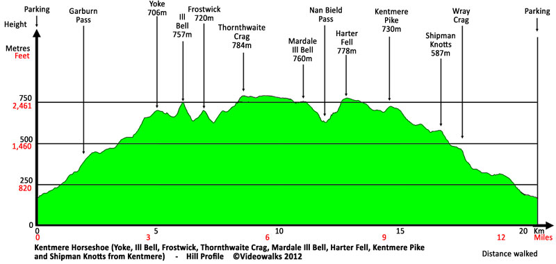
| Peaks / summits: | Yoke, Ill Bell, Froswick, Thornthwaite Crag, Mardale Ill Bell, Harter Fell, Kentmere Pike, Shipman Knotts and Wray Crag |
| Wainwrights: | Yoke: 2320ft / 707m - 85th highest Ill Bell: 2484ft / 757m - 60th highest Froswick: 2362ft / 720m - 77th highest Thornthwaite Crag: 2572ft / 784m - 44th highest Mardale Ill Bell: 2493ft / 760m - 59th highest Harter Fell (Mardale): 2556ft / 779m - 47th highest Kentmere Pike: 2397ft / 731m - 72nd highest Shipman Knotts: 1926ft / 587m - 133rd highest |
| Map: | Ordnance Survey - Explorer OL7 (The English Lakes - South-eastern Area) Buy this map from Ordnance Survey |
| Walk features: | Birds, Cafe, Flowers, Hills or Fells, Lake, Stream or River, Views, Waterfall, Wildlife |
| Facilities / refreshments: | Pubs and Wilf's Cafe in Staveley 3.5 miles away |
| Nearest town: | Walk starts in Kentmere. Staveley is 3.5 miles away - the next large town is Windermere |
| Local self-catering accommodation: | View self-catering accommodation close to the start of this walk |
| Local hotels, inns and B&Bs: | View hotels and inns close to the start of this walk from The Inn Collection Group |
| Walk Tags: | Video walk, Lake District, Cumbria, Wainwright, Kentmere, Yoke, Ill Bell, Froswick, Thornthwaite Crag, Mardale Ill Bell, Harter Fell, Kentmere Pike, Shipman Knotts, Wray Crag, Badger rock, Garburn pass, Garburn road, Rainsborrow crag, Kentmere reservoir, High Street, Blea water, Nan Bield Pass, Small water crag, Haweswater, Longsleddale, St Cuthbert's church, Video walks, Videowalks |
| Video run time: | 32 minutes 46 seconds |
Hill profile:
Downloads are available in different resolutions for your PC, SmartPhone and other mobile devices and are provided in mp4 format for maximum compapability with a wmv version also available. You also receive a PDF document with the walk details and an Ordnance Survey map extract that you can print out or view on your mobile device. Watch the video on your PC or burn to a CD or DVD to watch on your TV to see in detail the walk before you set off.
All downloads are available instantly.
Once saved to you device, you can then play them an unlimited number of times whenever you want!